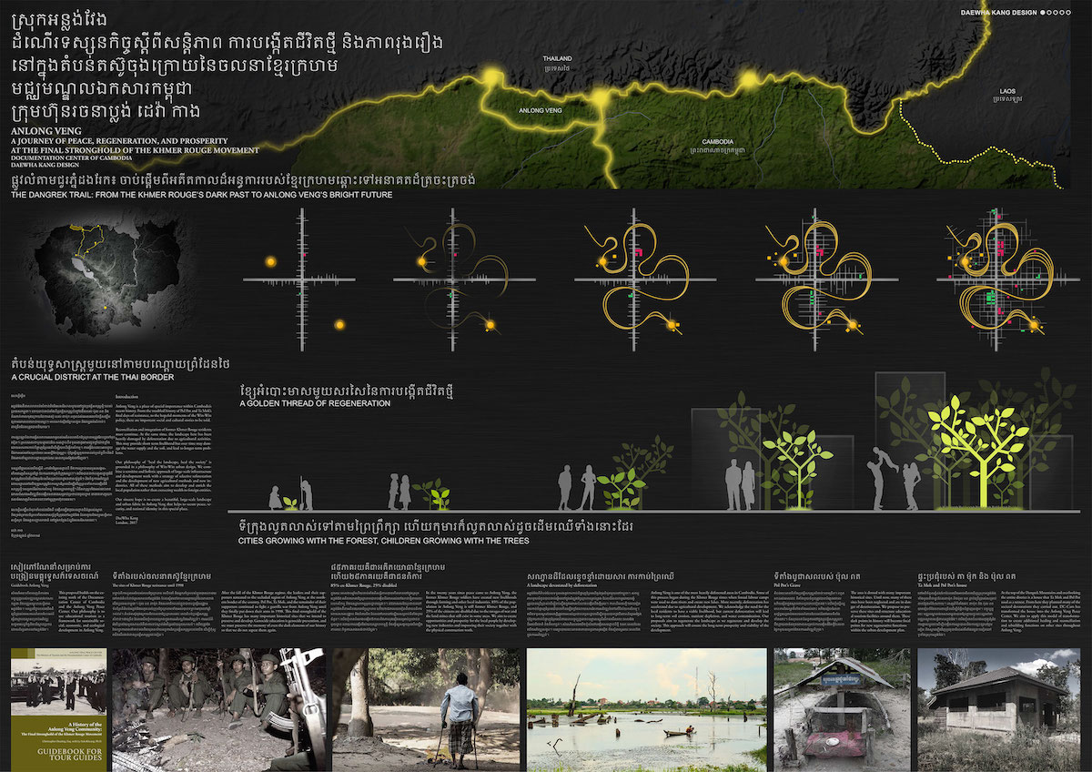
The Documentation Center of Cambodia has worked with London studio DaeWha Kang Design to create a new vision for the district of Anlong Veng, the final stronghold of the Khmer Rouge movement.
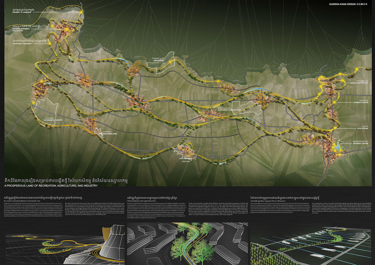
This project aims to create a city of peace, reconciliation, and regeneration in a place known until now for violence and trauma. At the foot of the Dangrek Mountains on the remote northern border with Thailand, Anlong Veng has deep connections to Cambodia’s dark past. Following their brief but brutal rule characterised by the “killing fields” and the deaths of up to two million Cambodians, the Khmer Rouge were ousted from power by invading Vietnamese forces. It was to the mountains and jungles of Anlong Veng that Pol Pot and the Khmer Rouge regime fled, and from this place continued a guerrilla war for twenty more years. Finally in the late 1990’s, the last of the Khmer Rouge agreed to put down their arms and return to ordinary society. But the last twenty years of peace have not erased the history of this place, or the physical sites of factional violence, forced labour, brutal killings, and even the detention house, cremation site, and grave of Pol Pot himself. Eighty-five percent of the residents of Anlong Veng today are ex-Khmer Rouge, most of whom make their living from slash and burn agriculture that has resulted in some of the worst deforestation in the country.
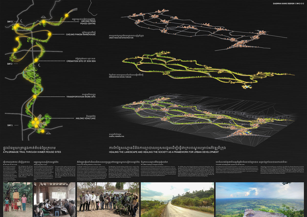
The Documentation Center of Cambodia has begun a process of reconciliation, engagement, and education by transforming a cliff-top house used by Pol Pot and other senior Khmer Rouge to plan their violence, into the Anlong Veng Peace Center. DaeWha Kang Design’s approach is to take a holistic strategic view across the entirety of the 50km-long Anlong Veng district, using the philosophy “heal the landscape, heal the society.” We combine a sensitive approach of large-scale infrastructure and development work with a strategy of selective reforestation and the development of new agricultural methods and new industries.
A system of “golden threads” creates serpentine landscape interventions designed to structure and rehabilitate the landscape. Ribbons of linear reforestation are combined with earthworks and waterways to mitigate soil degradation and provide control points for parks, green corridors, recreational sites, and public facilities. The serpentine flow of the narrow ribbons is designed to minimise the loss of agricultural land. In this way we maintain the current livelihood of Anlong Veng’s farmers while securing the future productivity of the land.